Routes & events · MTB Evolution
MTB Routes in Bosnia and Herzegovina
MTB routes in Bosnia and Herzegovina: MTB Evolution publishes 11 routes, from a 13 km family ride to a 58 km marathon. Every route lists distance, climbing and ITRS difficulty, and most come with a GPX track for Garmin or Wahoo. Compare them and pick the one that matches your fitness.
11
routes in BiH
13–58 km
distance range
ITRS 5.2
difficulty rating
In short
- Shortest route: Giro di Ćiro Sarajevo – Pale, 13 km and 146 m of climbing, ITRS 45.
- Longest route: Visočica, 58.2 km and 1,708 m of climbing, ITRS 175.
- Highest ITRS score: Bjelašnica – Lukomir, 460 (54.8 km, 1,400 m of climbing).
- Technique L1, fitness L2: Visočica and Borike.
- 2026 events: Romanija Zove 6, Tour of BiH and the UCI Belgrade – Banja Luka race are finished, and their pages stay as an archive.
Guide
How to choose an MTB route in BiH
MTB routes in BiH vary a lot: from a 13 km family ride along the old Ćiro railway to a 58.2 km marathon with 1,708 m of climbing on Visočica. That is why every route on MTB Evolution lists distance, climbing and ITRS difficulty, so you know what awaits before you set off.
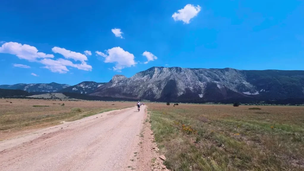
The easiest way to start is distance. Routes under 30 km, like Giro di Ćiro and MTB Borike, suit recreational riders and unhurried rides. Routes of 30 to 50 km, including Termag, Igman, Ulobić – Tvrdimići and Hojta, demand solid fitness. Marathons above 50 km, such as Ćirina pruga across Trebević, Lukomir, Kalinovik – Borilovačko Lake and Visočica, are for riders used to full-day tours.
Distance is not the whole story. Two routes of the same length can differ greatly in technique, remoteness and exposure, so always read difficulty through all four dimensions of the ITRS (International Trail Rating System). You will find the explanation and a difficulty calculator in the ITRS trail classification.
MTB Evolution has been building MTB trails and servicing bikes in East Sarajevo since 2015, so we don't pick the routes on this page from a catalogue: we map and document them ourselves. If you need help choosing, see the guide to the Olympic mountain trails or the MTB Bosnia destination overview.
All routes
MTB routes in Bosnia and Herzegovina: 11 routes from shortest to longest
Routes are sorted by distance. The ITRS score is the overall difficulty rating under the ITRS 5.2 standard, and you will find technique and fitness levels (L1–L4) in each route's description. Every route on this list is among the MTB routes in Bosnia and Herzegovina that we have mapped ourselves.
Pale – Sarajevo
Giro di Ćiro Sarajevo – Pale
13 km
distance
146 m
climbing
45
ITRS
A family ride along the old railway to Kozija Bridge and Darivo. Technique L1, fitness L1.
Rogatica
MTB Borike 2026
30 km
distance
565 m
climbing
175
ITRS
A loop through pine forests north of Rogatica. Technique L1, fitness L2.
Trebević
Trebević: bobsled track and Ćirina pruga
34.6 km
distance
967 m
climbing
406
ITRS
A loop over the Olympic bobsled track. Technique L1, fitness L3.
Marathon 2026
Red Trail Termag
37 km
distance
978 m
climbing
319
ITRS
A looped marathon route. Technique L2, fitness L3.
Igman
Igman 40 km challenge
39.8 km
distance
1,236 m
climbing
400
ITRS
A loop through the Igman forests. Technique L2, fitness L3.
East Sarajevo
Ulobić – Tvrdimići
42.3 km
distance
1,133 m
climbing
363
ITRS
A loop via Karaula and Ulobić to Beli Vuk. Technique L2, fitness L3.
Bjelašnica
Bjelašnica – Hojta
49 km
distance
1,290 m
climbing
422
ITRS
A looped ridge ride over Hojta. Technique L2, fitness L3.
Sarajevo
Ćirina pruga: marathon across Trebević
51.4 km
distance
1,075 m
climbing
347
ITRS
A loop ridden in both directions. Technique L1, fitness L3.
Bjelašnica
Bjelašnica – Lukomir
54.8 km
distance
1,400 m
climbing
460
ITRS
A loop through Lukomir, Čuhovići and Blatca. Technique L2, fitness L3.
Zelengora
Kalinovik – Borilovačko Lake
55 km
distance
1,074 m
climbing
351
ITRS
An out-and-back route through Zelengora. Technique L2, fitness L3.
Rakitnica
Visočica, epic marathon route
58.2 km
distance
1,708 m
climbing
175
ITRS
A loop above the Rakitnica canyon. Technique L1, fitness L2.
Navigation
GPX tracks for MTB routes in Bosnia and Herzegovina: how to use them
For most MTB routes in Bosnia and Herzegovina on this page you can download a GPX track and load it into a Garmin or Wahoo device, or into an app such as Strava and Trailforks. GPX tracks for MTB routes are the safest way to stay on course, because trail markings in the mountains are not always reliable.
All maps and tracks are collected on the Maps and GPX tracks page. The Bike Park Evolution trails are also mapped on Trailforks, where MTB Evolution has had admin access since 2019.
Before you set off, check your device battery, the weather forecast and that the track is loaded into your navigation. For long rides carry water, food and basic tools.
By area
MTB trails in BiH and cycling routes around Sarajevo
Most routes start near Sarajevo, so cycling routes from Sarajevo to Pale, over Trebević, Igman, Bjelašnica and Jahorina are the easiest to plan from the city. For MTB trails in BiH further from Sarajevo we highlight Romanija, Zelengora and Visočica. Here is an overview by area.
Trebević and Ćirina pruga
Trebević is the mountain closest to the city. The routes are Trebević: bobsled track and Ćirina pruga (34.6 km) and the Ćirina pruga across Trebević marathon of 51.4 km. Giro di Ćiro follows the old railway between Sarajevo and Pale and is the shortest route on the page, 13 km.
Igman
Igman 40 km challenge is a 39.8 km loop through the forests of a mountain known for its Olympic heritage. It is part of the Olympic mountain trails series.
Bjelašnica, Hojta and Lukomir
Bjelašnica offers two long rides: Bjelašnica – Hojta (49 km) and Bjelašnica – Lukomir (54.8 km, 1,400 m of climbing). Lukomir has the highest ITRS score on the page, 460, and is meant for well-prepared riders.
Jahorina and East Sarajevo
Red Trail Termag (37 km) and Ulobić – Tvrdimići (42.3 km) run around Jahorina. Ulobić – Tvrdimići starts in East Sarajevo and combines an urban start with the wilderness of Jahorina's foothills.
Romanija and Rogatica
MTB Borike is a 30 km loop through the pine forests of the Romanija region, organised by the Rogatica Municipality Tourism Organisation. The Romanija Zove 6 marathon is also held in Sokolac.
Zelengora
Kalinovik – Borilovačko Lake is a 55 km out-and-back route, mostly on wide gravel roads through Sutjeska National Park.
Visočica
Visočica, epic marathon route is the longest route on the page: a 58.2 km loop with 1,708 m of climbing and an ITRS score of 175, over high ridges and past canyons in Herzegovina.
Events
2026 events: finished editions
An overview of 2026 events that have already taken place. Routes and results remain available on the event pages.
Sokolac · 13 June 2026
Romanija Zove 6
The Romanija Zove 6 MTB marathon in Sokolac, with a route page and event details.
Finished
BiH · 17–19 April 2026
Tour of Bosnia and Herzegovina 2026
A three-day international cycling stage race through Bosnia and Herzegovina.
Finished
Belgrade – Banja Luka · 22–25 April 2026
UCI Race Belgrade – Banja Luka 2026
An international UCI race on the Belgrade – Banja Luka route.
Finished
Route difficulty
How to read ITRS route difficulty
We rate every one of the MTB routes in Bosnia and Herzegovina on this page under ITRS 5.2 across four dimensions instead of a single difficulty label. That way you can see whether a route is hard technically, physically, because of distance from help, or because of exposure.
Technique
How much technical skill the terrain, rocks, roots and descents demand.
Fitness and logistics
Distance, climbing and ride duration, and what food, water and gear you need to carry.
Wilderness
How far the route is from settlements, help and mobile signal.
Exposure
Steep drop-offs, precipices and weather in open terrain.
Preparation
Season and gear for long MTB routes in Bosnia and Herzegovina
Weather in the mountains can change quickly, especially on high routes like Bjelašnica, Visočica and Zelengora. Before every ride check the forecast, and early in the season the condition of the terrain.
Along with a working bike, carry a windbreaker, enough water and food, a spare tube or tubeless kit and basic tools. Before a long ride have your bike checked at the MTB Evolution workshop, and you can book a slot online.
E-bikes are welcome on most routes, but on longer rides plan your battery range, because charging points are not always available in remote villages. Find more on safe riding in the MTB trail safety guide.
Preparation
Before you hit the route
Long MTB routes in Bosnia and Herzegovina call for the right gear and a realistic view of your fitness. Here is where to find what you need on the site.
Bike service
Check brakes, drivetrain, tyres and suspension before a longer ride. The MTB Evolution workshop is in East Sarajevo.
Bike Park trails
For shorter rides and practising technique before long routes, see the Bike Park Evolution trails.
FAQ
Frequently asked questions about MTB routes in Bosnia and Herzegovina
How many MTB routes does MTB Evolution publish in BiH?

There are currently 11 published routes, from the 13 km Giro di Ćiro family ride to the 58.2 km Visočica marathon. Each lists distance, climbing and ITRS difficulty.
What is the easiest route for beginners and families?
The shortest is Giro di Ćiro Sarajevo – Pale, at 13 km. Before choosing, still check the climbing and ITRS rating on the route page and assess your own fitness.
What is ITRS and how is route difficulty calculated?
ITRS 5.2 is a classification system that rates route difficulty across four dimensions: Technique, Fitness and logistics, Wilderness and Exposure. Find details and a calculator on the ITRS classification pages.
Do all routes have a GPX track for Garmin or Wahoo?
Most routes have a GPX track to download. Check the page of the specific route, and you can find all maps and tracks on the Maps and GPX tracks page.
Which is the longest and which the most demanding route?
The longest is Visočica at 58.2 km, and the highest ITRS value (460) belongs to Lukomir. Always read difficulty through all four ITRS dimensions, not just distance.
How should I prepare before a longer MTB ride?
Check your bike (brakes, drivetrain, tyres, suspension), carry water, food and basic tools, and read the trail safety advice. We service bikes in East Sarajevo.
Pick a route and go
Download the GPX track, check the ITRS difficulty and prepare your bike. If you need a service before the ride, get in touch.