Routes and events · Trebević
Trebević Mountain Biking: 3 Routes, Bobsled Track and Ćiro Railway
Trebević mountain biking: three routes from 13 to 51.4 km around Sarajevo, over the Olympic bobsled track and the historic Ćiro railway, with GPX track, elevation gain and ITRS difficulty.
3
routes on Trebević
13–51.4 km
length range
45–406
ITRS score range
At a glance
- Shortest route: Giro di Ćiro Sarajevo – Pale, 13 km and 146 m of climbing, ITRS 45.
- Longest route: Ćiro railway marathon, 51.4 km and 1,075 m of climbing, ITRS 347.
- Hardest by ITRS: Trebević, bobsled track and Ćiro railway, ITRS 406 (34.6 km, 967 m of climbing).
- Bobsled track: technique L1, fitness L3; water sources are scarce, so carry about 1.5 l.
About the area
Trebević mountain biking: the Olympic mountain above Sarajevo
Trebević mountain biking is the best-known riding area around Sarajevo. The mountain preserves the concrete Olympic bobsled track from 1984 and the route of the narrow-gauge Ćiro railway towards Pale.
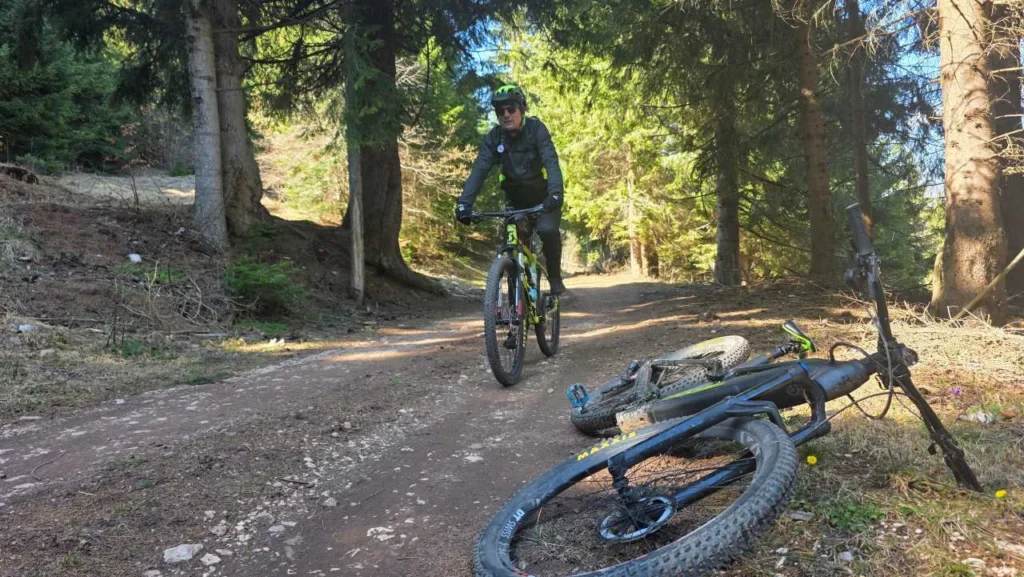
The routes are part of the Trails of the Olympic Mountains series. Choose by length: 13 km is a family ride along the old railway to Kozija ćuprija (Goat Bridge) and Darivo, 34.6 km is a loop over the bobsled track, and 51.4 km is a marathon across Trebević.
The bobsled track is technically easy (L1) but calls for caution, while the return from Pale is a serious fitness workout (L3). Water sources are scarce (at 7–25 km), so carry about 1.5 l of water and ride with a helmet.
You can compare these routes with other trails on the MTB routes in Bosnia and Herzegovina page, and you'll find a guide to the regions on the MTB Bosnia page.
Routes
3 MTB routes on Trebević
From a family ride along the old railway to a marathon across Trebević. Each route lists its length, elevation gain and ITRS difficulty.
Navigation
GPX tracks for Trebević mountain biking
For the Trebević routes you can download a GPX track and load it onto a Garmin or Wahoo device, or into an app such as Strava or Trailforks. A GPX track is the surest way to stay on the right route.
All maps and tracks are collected on the Maps and GPX tracks page. MTB Evolution has been a Trailforks admin since 2019.
Before you set off, check your device's battery, the weather forecast and that the track is loaded into your navigation. For rides from Pale, carry water, food and basic tools.
Route difficulty
How to read a route's ITRS difficulty
On this page we rate all MTB routes in Bosnia and Herzegovina using ITRS 5.2 across four dimensions instead of a single difficulty label. That way you can see whether a route is hard technically, physically, because of distance from help, or because of exposure.
Technique
How much technical skill the terrain, rocks, roots and descents demand.
Fitness and logistics
Distance, climbing and ride duration, plus the food, water and gear you need to carry.
Remoteness
How far the route is from settlements, help and mobile signal.
Exposure
Steep drop-offs, precipices and weather in open terrain.
FAQ
Frequently asked questions about Trebević mountain biking
How long are the MTB routes on Trebević?

There are three routes on Trebević: 13 km (146 m of climbing), 34.6 km (967 m of climbing) and 51.4 km (1,075 m of climbing). Each has a GPX track, and we rate difficulty using ITRS.
Which Trebević MTB route is best for beginners?
Giro di Ćiro Sarajevo – Pale: 13 km and 146 m of climbing, ITRS 45, technique L1 and fitness L1. It's a family ride along the old railway to Kozija ćuprija (Goat Bridge) and Darivo.
Is the Trebević bobsled track dangerous on a bike?
It's technically easy (L1), but you need to be careful on the concrete bobsled track. Always ride with a helmet and adjust your speed.
Is there water on the Trebević MTB routes?
Water sources are scarce, at around 7 to 25 km of the route. For the ride over the bobsled track, carry about 1.5 l of water.
Where can I download the Trebević GPX track?
The GPX track is on each route's page, and you can find all the tracks on the Maps and GPX tracks page.
How is route difficulty rated on Trebević?
We use ITRS 5.2 across four dimensions: technique, fitness and logistics, remoteness and exposure. That way you can see whether a route is hard technically, physically, or because of distance from help.
Planning Trebević mountain biking?
Download the GPX, get your bike ready and book a service before the ride.