Routes and events · Jahorina
Jahorina MTB routes: 2 marathon loops, Termag and Tvrdimići
Jahorina MTB routes: two marathon loops of 37 and 42.3 km, the Red Trail Termag and the loop via Ulobić to Beli Vuk, with GPX track, elevation gain and ITRS difficulty.
2
routes on Jahorina
37–42.3 km
length range
319–363
ITRS score range
At a glance
Shorter route: Red Trail Termag, 37 km and 978 m of climbing, ITRS 319.
Longer route: Tvrdimići, 42.3 km and 1,133 m of climbing, ITRS 363.
Both routes are technically L2 and physically L3.
The Red Trail is the course of the Termag MTB marathon, and the loop via Ulobić has three water sources.
About the area
Jahorina MTB routes: an Olympic mountain, gravel roads and ski slopes
The Jahorina MTB routes include two marathon loops for well-prepared riders. The Red Trail runs over Ravna Planina and the Prača ski slope, while the loop from East Sarajevo goes via Ulobić to Beli Vuk and Tvrdimići.
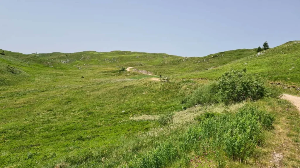
The routes are part of the Trails of the Olympic Mountains series. Choose by length: 37 km is a circular marathon route starting at the Koliba ethno restaurant, and 42.3 km is a loop starting in East Sarajevo.
Both routes are technically undemanding (L2) but physically serious (L3). On the Red Trail the hardest part is the long climb up the Prača ski slope, while on the Ulobić loop the water sources are near the end of the climb to Ružica, after the Kasindolka canyon and at Beli Vuk.
You can compare the routes with other trails on the MTB routes in BiH page, and the guide to the regions is on the MTB Bosnia page.
Routes
2 MTB routes on Jahorina
From the Red Trail Termag marathon to the loop via Ulobić and Beli Vuk. Each route lists its length, elevation gain and ITRS difficulty.
Navigation
GPX tracks for Jahorina mountain biking
For the Jahorina routes you can download a GPX track and load it onto a Garmin or Wahoo device, or into an app such as Strava or Trailforks. A GPX track is the safest way to stay on course.
All maps and tracks are collected on the Maps and GPX tracks page. MTB Evolution has been a Trailforks administrator since 2019.
Before you set off, check your device battery, the weather forecast and that the track is loaded into your navigation. On the Ulobić loop, forest roads can be confusing, so we recommend using the GPX track.
Route difficulty
How to read the ITRS route difficulty
We rate all MTB routes in BiH on this page using ITRS 5.2 across four dimensions, instead of a single difficulty label. That way you can see whether a route is hard technically, physically, because of distance from help, or because of exposure.
Technique
How much technical skill the terrain, rocks, roots and descents demand.
Fitness and logistics
Length, elevation gain and duration of the ride, and what food, water and gear you need to carry.
Remoteness
How far the route is from settlements, help and mobile signal.
Exposure
Steep drop-offs, precipices and weather conditions in open terrain.
FAQ
Frequently asked questions about Jahorina MTB routes
How long are the MTB routes on Jahorina?

There are two routes on Jahorina: the 37 km Red Trail (978 m of climbing) and the 42.3 km loop via Ulobić and Beli Vuk (1,133 m of climbing). Each has a GPX track, and we rate difficulty using ITRS.
Where does the Red Trail of the Termag MTB marathon start?
The start is in front of the Koliba ethno restaurant on Jahorina. Riders go as a group on asphalt, escorted by a safety vehicle, to the turn-off onto the gravel road toward Ravna Planina.
What is the hardest section on Jahorina?
On the Red Trail it is the long, steep climb up the Prača ski slope to the top of Ravna Jahorina. The Ulobić loop has 1,133 m of climbing and short, very steep sections.
Is there water on the Jahorina MTB routes?
The Ulobić loop has three water sources: near the end of the climb to Ružica, on the climb after the Kasindolka canyon, and a fountain at the Beli Vuk amphitheater. At the Termag marathon, the organizer provides aid stations.
Where can I download a GPX track for Jahorina?
The GPX track is on each route's page, and you can find all tracks on the Maps and GPX tracks page.
Can the Jahorina routes be ridden on an e-bike?
Yes. The Red Trail is described as a good proving ground for e-MTB, and the Ulobić loop suits XC, gravel and e-bikes.
Planning a Jahorina ride?
Download the GPX, prepare your bike and book a service before the ride.