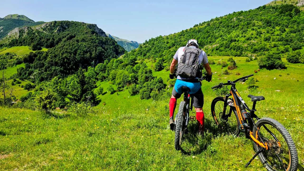
The Bjelašnica MTB loop is a 50-kilometre epic that takes you from urban Babin Do through the authentic villages of Umoljani and Sinanovići, all the way to the wild slopes of Hojta and the foot of Treskavica. This ride is part of our series Trails of the Olympic Mountains.
This Bjelašnica MTB loop is full of contrasts: hard climbs that test your character, spectacular viewpoints that reward the effort, and fast gravel descents through untouched nature. Get ready for a serious fitness test in the heart of an Olympic mountain.

ITRS 5.2 Official Report
Technically undemanding trail, just enjoy the ride.
Serious fitness workout. Expect significant fatigue. Water sources are scarce (7-25 km). Carry about 1.5 L of water.
Signal is unstable (30-70%). High risk of wildlife (bears/wolves)! Evacuation is difficult.
Steep, but the trees offer cover. Stay alert.
📊 Bjelašnica MTB Loop: Stats and Profile
The Numbers
- 📏 Total distance: 49.0 km
- 📈 Total ascent: 1,290 m
- 📉 Total descent: 1,290 m
- 🔼 Highest point: 1,268 m
- ⏱️ Estimated time: 4 - 6 hours
- ⛰️ Maximum gradient: 38.9%
Setup
- ✅ Surface: Gravel (dominant), asphalt
- 🚲 Bike type: AM, XC, Gravel, E-Bike
- 📡 Signal: Unstable (30-70% coverage)
- 💧 Water: Vrelo Stublo spring, Fatmina Česma fountain
- 🗺️ Route type: Loop
Bjelašnica MTB Loop Route Description
Set off on a journey that combines Olympic infrastructure with the wilderness of Hojta mountain. This Hojta MTB route is physically demanding but technically accessible, which makes it ideal for fit adventurers.
1. The Vertical Start: Babin Do to Vrelo Stublo
The route starts in the centre of Babin Do on Bjelašnica. Right away you get a "cold shower": about 5 km of hard climbing. It is the toughest part mentally, but the reward comes quickly.
As you climb, incredible views open up over the surrounding peaks. You pass the famous Kuća Spasa, and the first key point is Vrelo Stublo (at 5.5 km). It is the ideal spot for a first break, a water refill and a breather after that brutal start.
2. Panoramic Rollers: Umoljani and Sinanovići
After Stublo, ride about another 2.5 km before turning left towards the village of Umoljani. Here the terrain turns rolling with a slight downhill tendency, offering beautiful views of the Rakitnica canyon. Riding into Umoljani is a ride through history.
From Umoljani, the route leads over the Tušila pass towards the village of Sinanovići (about 10 km of riding). In Sinanovići you turn left onto a gravel road that leads into the heart of the forest.
3. The Wilds of Hojta: Climb to Bijela Lijeska
The section from Sinanovići is 11.5 km long. The first 3.5 km is a climb through dense forest, followed by a "downhill" reward and flat sections leading to Fatmina Česma. You are at the foot of Treskavica mountain, so top up your water, because you are deep in the wilderness.
Next comes the summit of Bijela Lijeska on Hojta. This is the essence of the Bjelašnica MTB loop experience. Another 4 km of climbing awaits you. It is a test of endurance, but also a chance to enjoy the peace of Hojta mountain, which rarely sees tourists.
4. The Return: Javorov Do and the Finale
From Hojta, a 3 km descent takes you to the road towards Javorov Do. You ride along the slopes of Hojta with constantly alternating climbs and descents. By the time you reach Javorov Do, you are already at kilometre 45.
To finish, there is one more long, loose-gravel climb that will squeeze out your last drops of energy, before you hit the asphalt and roll back down to the starting point in Babin Do.
⭐ Rider Reviews
"That first 5 km almost broke me, but the water at Stublo brought me back to life. The area around Hojta is total wilderness, we saw wolf tracks and hurried towards Javorov Do. Top-class adventure!" — ⭐⭐⭐⭐⭐ Kenan M., Sarajevo
🗺 Map and Navigation
Because of the unstable signal (30-70% coverage) and the tangle of forest roads on Hojta, a GPS device is a must on this Bjelašnica MTB loop. Grab the GPX file below and load it before you leave.
❓ Frequently Asked Questions (FAQ)
Is the route suitable for an E-Bike?
👉 Yes, it is great for an E-Bike thanks to the big elevation gain (1290 m). Save battery on the flat sections around Umoljani.
Where can I refill water?
👉 There are two reliable points: Vrelo Stublo (5.5 km) and Fatmina Česma (foot of Treskavica). Carry at least 1.5 L with you at the start.
What is the surface like?
👉 Mostly gravel and forest roads, with asphalt sections at the start and the end. It is not technically hard (L2), but it demands good fitness.
Ready for Hojta?
This Bjelašnica MTB loop is not for beginners when it comes to fitness. Check your brakes before the descent and pack enough food for 5-6 hours in the saddle.