MTB route · Bjelašnica · Lukomir marathon
Bjelašnica MTB Marathon: Lukomir, Čuhovići and Blatca – 55 km
This Lukomir MTB route is a 55 km marathon loop through Bjelašnica to the village of Lukomir, then across the plateau to Čuhovići and Blatca, with 1400 m of climbing. Guide, map, GPX and ITRS difficulty rating in one place.

Length
55 km
Descent
−1400 m
Highest point
1589 m
Climb
1400 m
ITRS score
460

Difficulty (ITRS)
Blue route (L2)
Gravel, asphalt and dirt

Physical effort
Demanding (L3)
1400 m of climbing over 55 km
ITRS Route Pie: route difficulty at a glance
The Route Pie shows the ITRS rating of the route across four axes: technique, fitness and logistics, wilderness and risk, and exposure. Click the chart to open an explanation of difficulty, demands and the other parameters.
About the route
Lukomir MTB route: Bjelašnica marathon to Blatačko Lake
This Bjelašnica MTB marathon leads from Babin Do across the plateau to the village of Lukomir (1495 m), the highest permanently inhabited village in Bosnia and Herzegovina, and then on to the villages of Čuhovići and Blatca. The route is part of our series Trails of the Olympic Mountains.
The route at a glance
- Length 55 km, climb 1400 m, descent 1400 m (highest point 1589 m, lowest 1183 m).
- ITRS score 460: technique L2, fitness L3, wilderness L4, exposure L1.
- Surface: gravel (about 70%), asphalt (about 20%) and dirt (about 10%).
- No mobile signal and difficult evacuation (over 6 h): a GPS or offline map is a must.
- Estimated riding time is 4 to 6 hours, and water sources are scarce (Babin Do, Lukomir).
This is not an ordinary ride but a strategic challenge. The route is technically easy but long, with no signal and no shelter from the wind, so good preparation matters as much as fitness.
Key sections of the route
01
The climb from Babin Do to Lukomir
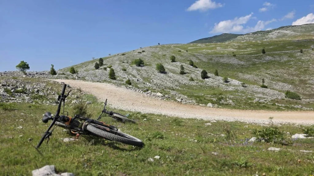
The route starts in Babin Do and follows asphalt towards Ština Do, a gentle warm-up. Then the asphalt turns to gravel, the trees thin out and the views open up, with the constant wind of Bjelašnica.
02
Lukomir and the Rakitnica canyon
After the pass you enter a zone of high mountain pastures and sharp rock all the way to Lukomir (1495 m). It is a good spot for a break and a view of the Rakitnica canyon.
03
Čuhovići, Blatca and Blatačko Lake
The route then crosses the plateau towards the villages of Čuhovići and Blatca, with a panoramic view of Blatačko Lake. The terrain is more technical and dynamic, with fast gravel descents, and the strongest climbs wait on the way back.
Stick to the beaten tracks
Bjelašnica has suspected mine areas off the trails. Ride only on existing roads and gravel tracks, and do not go into unmown meadows or groves.
Route characteristics: Lukomir – Čuhovići – Blatca
Primary activity
Cross-country, e-MTB
Route type
Loop route
E-bikes
Suitable, with battery planning for 55 km
Signal
No signal (isolation)
Water
Scarce sources (Babin Do, Lukomir)
Physical demands
Demanding (L3)
Surface
Gravel, asphalt, dirt
Trailforks
Lukomir MTB route map and elevation profile
The interactive map shows the route track and the elevation profile. Load the GPX before you set off.
Gear and riding tips
Mandatory
A helmet is mandatory. There is no mobile signal, so bring a GPS or offline map, a bottle or hydration pack of at least 1.8 l, and a tire repair kit.
Recommended
XC hardtail, full-suspension or e-MTB. The terrain around Blatca is rough, so a full-suspension bike adds comfort.
Weather
There is no shelter on the Bjelašnica plateau and the wind blows almost constantly. Pack layers even in summer, because the temperature can drop by 10 degrees in half an hour.
Pro tip
Check your tires and brakes before the marathon. We do bike service in our workshop by appointment: book a slot.
Frequently asked questions
Where does the Lukomir – Čuhovići – Blatca route start?

The route starts in Babin Do, the urban center of Bjelašnica. The first kilometers follow asphalt towards Ština Do, then gravel towards the plateau and Lukomir.
How demanding is this route physically?
It is demanding (ITRS L3): 55 km with 1400 m of climbing, and the strongest climbs come in the second half of the ride, on the way back. Estimated riding time is 4 to 6 hours.
Can I ride an e-bike on this route?
Yes, the route is suitable for e-MTB, but it is long and has no signal, so plan your battery for the whole ride.
Is there water on the route?
Sources are scarce: they are reliable at the start (Babin Do) and in the village of Lukomir. Carry at least 1.8 l of fluids.
How long is the Lukomir – Čuhovići – Blatca route?
The route is 55 km long (54.9 km by the GPX track), with 1400 m of climbing and descent. The highest point is 1589 m and the lowest is 1183 m.
Ready for Bjelašnica?
Prepare your bike, load the route and browse all MTB routes in Bosnia, or contact us for advice on gear and service.