MTB ROUTE · VISOČICA · RAKITNICA
Visočica Marathon Route – 58 km Epic MTB Loop
The Visočica marathon route is a 58.2 km loop over the Visočica ridge with a descent to Glavatičevo and 1,708 m of climbing. Guide, map, GPX and ITRS difficulty rating in one place.

Distance
58.2 km
Descent
−1,708 m
Highest point
~1,700 m
Climb
1,708 m
ITRS score
543

Difficulty (ITRS)
Green route (L1)
Gravel road, packed dirt and asphalt

Physical effort
Very demanding (L4)
1,708 m of climbing over 58 km
ITRS Route Pie: route difficulty at a glance
The Route Pie shows the route's ITRS rating across four axes: technique, fitness and logistics, wilderness and risk, and exposure. Click the chart to open an explanation of difficulty, demands and the other parameters.
About the route
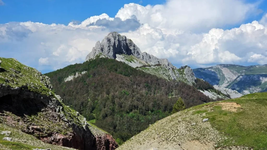
Visočica marathon route: the ridge above Rakitnica and the descent to Glavatičevo
The Visočica marathon route is a 58.2 km loop with 1,708 m of climbing and the same amount of descent. It follows the Visočica ridge at around 1,700 m along the edge of the Rakitnica canyon, drops to the Herzegovinian village of Glavatičevo at 353 m, then returns via a long 18 km climb. Technically it is easy (L1), but its length and elevation profile place it among the very demanding routes (L4).
The Red Trail in brief
- Distance 58.2 km, climb 1,708 m, descent 1,708 m (highest point about 1,700 m, lowest 353 m).
- ITRS score 543: technique L1, fitness L4, wilderness L1, exposure L1.
- Surface: gravel road, packed dirt and asphalt. Suitable for AM, XC, gravel and e-bikes.
- The descent to Glavatičevo is very long, and the way back is a nonstop 18 km climb.
- Signal is excellent (100% 4G), and fountains along the way are fairly frequent (carry at least 1.5 l of water).
Also check out the Bjelašnica MTB marathon to Lukomir on the other side of the canyon, or other MTB routes in Bosnia and Herzegovina. The difficulty is explained by the ITRS classification.
Key sections of the route
01
Start in Luka village and the climb to the plateau
The route starts near the village of Luka, reached by asphalt road. It quickly turns onto gravel and the first serious climb up the slopes of Visočica begins, with an average gradient of about 10% and roughly 400 m of elevation gain.
02
The ridge above the Rakitnica canyon
On the plateau, at around 1,700 m above sea level, the terrain becomes rolling gravel. You ride along the edge of the Rakitnica canyon, with views of Bjelašnica, the village of Blace and Lukomir.
03
Descent to Glavatičevo and 18 km back
From 1,700 m the descent leads to Glavatičevo at 353 m. Then comes a nonstop 18 km climb with about 880 m of elevation gain to close the loop.
Check your brakes and water
The descent to Glavatičevo is very long, and some fountains on the final climb dry up in summer. Check your brake pads before setting off and start with at least 1.5 l of water.
Visočica route features
Primary activity
58.2 km
Route type
1,708 m
E-bikes
1,708 m
Signal
~1,700 m
Water
353 m (Glavatičevo)
Physical demand
Gravel road, packed dirt, asphalt
Surface
AM, XC, gravel, e-bike
Trailforks
Visočica route map and elevation profile
The interactive map shows the route track and elevation profile. Load the Visočica GPX track before you set off.
Gear and riding tips
Required
Working brakes, helmet, spare tube, pump and at least 1.5 l of water.
Recommended
Windbreaker, energy bars and a fully charged phone or bike computer.
For racers
Load the GPX before you start and use the Trailforks app.
Pro tip
The descent is long: control your speed and let your brakes cool down before the 18 km climb back.
Frequently asked questions
Is the Visočica marathon route technically dangerous?

No. Technical difficulty is L1 under the ITRS standard: gravel road, packed dirt and asphalt, with no jumps, roots or rock gardens. The long descent does require speed control.
How physically demanding is the route?
Very demanding (ITRS L4, score 543): 58.2 km and 1,708 m of climbing, including the final 18 km climb out of Glavatičevo.
Is there enough water on the trail?
There are several fountains along the route, especially on the final climb from Glavatičevo, but some dry up in summer. Start with at least 1.5 l of water.
Which bike is best for this route?
XC, All-Mountain and gravel bikes are a good choice thanks to the mostly gravel surface. E-bike riders should plan their battery carefully because of the 1,708 m of climbing.
Where can I download the GPX and route map?
Download the GPX with the button at the top of the page. The map and elevation profile are on Trailforks (route 67542).
Ready for the epic Visočica challenge?
Prepare your bike, load the route and browse all MTB routes in Bosnia and Herzegovina, or contact us for advice on gear and servicing.