MTB route · Jahorina · Termag marathon
Red Trail Termag MTB Marathon – 37 km Jahorina
A 37 km marathon loop across Jahorina and Ravna Planina with 978 m of climbing. Guide, map, GPX and ITRS difficulty rating in one place.

Length
37 km
Descent
−978 m
Highest point
1549 m
Climb
978 m
ITRS score
319

Difficulty (ITRS)
Blue route (L2)
Gravel and packed dirt

Physical effort
Demanding (L3)
978 m of climbing over 37 km
ITRS Route Pie: route difficulty at a glance
The Route Pie shows the route's ITRS rating across four axes: technique, fitness and logistics, wilderness and risks, and exposure. Click the chart to open an explanation of difficulty, demands and the other parameters.
About the route
Red Trail Termag MTB marathon: a fitness test on Jahorina
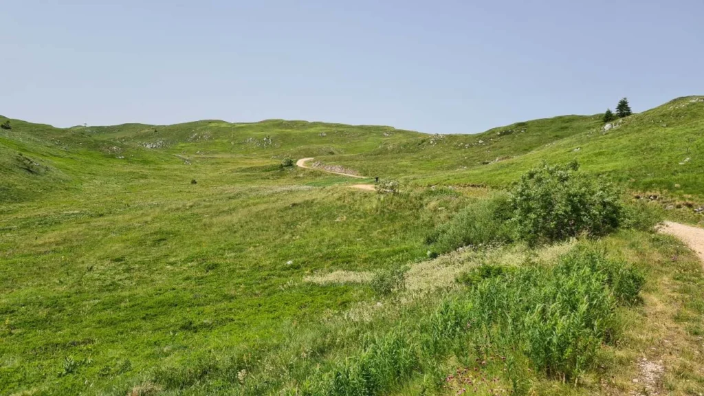
The Red Trail of the Termag MTB marathon is a 37 km loop with 978 m of climbing and descent. It runs through the most beautiful and challenging parts of Jahorina and Ravna Planina, from the start at the Koliba ethno restaurant, past the Ravna Planina ski resort and along the Prača ski run to Ogorjelica. The ITRS rating is 319 points (technique L2, fitness L3, wilderness L2).
The Red Trail in brief
- Length 37 km, climb 978 m, descent 978 m (highest point 1549 m, lowest 1293 m).
- ITRS score 319: technique L2, fitness L3, wilderness L2, exposure L1.
- Surface: packed dirt and gravel. XC and e-bikes are allowed.
- The hardest part is the long climb up the Prača ski run to the top of Ravna Jahorina.
- The marathon has aid stations, and phone signal is mostly reliable (over 70%).
You can find other routes on Jahorina on the MTB Jahorina page or among the MTB routes in Bosnia and Herzegovina. The difficulty is explained by the ITRS classification.
Key sections of the route
01
Start at Koliba and descent to Ravna Planina
The start is in front of the Koliba ethno restaurant on Jahorina. You ride as a group on asphalt behind a safety car until the turn onto gravel, then take a gently rolling descent to the Ravna Planina ski resort and the aid station.
02
Climb up the Prača ski run
After the ski resort, the route turns left onto the hardest section: a steep, exhausting climb up the Prača ski run to the top of Ravna Jahorina.
03
Ogorjelica and the return
A short breather at the top is followed by a mix of short descents and technical climbs to Ogorjelica. The way back to the start follows wide, fast gravel.
Save your legs for Prača
This segment breaks legs. After you reach Ravna Jahorina, the pace stays high all the way to Ogorjelica, so save your strength.
Red Trail characteristics
Primary activity
Cross-country, e-MTB
Route type
Loop route
E-bikes
Allowed, ideal for the climbs
Signal
Mostly available (over 70%)
Water
Aid stations during the marathon
Physical demand
Demanding (L3)
Surface
Packed dirt, gravel
Trailforks
Red Trail Termag map and elevation profile
The interactive map shows the route track and elevation profile. Load the GPX before you set off.
Gear and riding tips
Required
A helmet is mandatory. The marathon has aid stations, but bring a bottle and a tire repair kit.
Recommended
An XC bike or e-MTB. The Red Trail is a good testing ground for e-bikes on the technical climbs toward Ogorjelica.
For racers
The start is ridden as a group on asphalt behind a safety car, so save your energy for the climb.
Pro tip
Check your tires and brakes before the marathon. We do bike service in our workshop by appointment: book a slot.
Frequently asked questions
Where does the Termag Red Trail start?

The start is in front of the Koliba ethno restaurant on Jahorina. You ride as a group behind a safety car on asphalt until the turn onto gravel toward Ravna Planina.
How physically demanding is the Red Trail?
Very (ITRS L3). The biggest challenge is the long climb up the Prača ski run, with 978 m of total climbing over 37 km.
Are e-bikes allowed on the Red Trail?
Yes, the e-MTB category is allowed, and the trail suits electric bikes on the short technical climbs.
Will there be water on the course?
The organizer provides official aid stations, for example at the Ravna Planina ski resort, so there is no need to carry large water supplies.
How long is the Termag Red Trail?
The route is a 37 km loop with 978 m of climbing and 978 m of descent. The highest point is 1549 m and the lowest is 1293 m.
Ready for the Termag MTB marathon?
Get your bike ready, load the route and browse all MTB routes in Bosnia and Herzegovina, or contact us for advice on gear and service.