MTB route · Jahorina · East Sarajevo
East Sarajevo – Tvrdimići MTB Marathon
A 42.3 km East Sarajevo MTB route loop via Karaula, Ulobić and Beli Vuk to Tvrdimići. Guide, map, GPX and ITRS difficulty rating in one place.

Distance
42.3 km
Descent
−1117 m
Average time
3 – 5 h
Climb
1133 m
ITRS score
363

Difficulty (ITRS)
Blue route (L2)
Gravel and forest roads

Physical effort
Demanding (L3)
1133 m of climbing over 42.3 km
ITRS Route Pie: route difficulty at a glance
The Route Pie shows the route's ITRS rating across four axes: technique, fitness and logistics, wilderness and risks, and exposure. Click the chart to open an explanation of difficulty, demands and other parameters.
About the route
East Sarajevo MTB route to Tvrdimići: a marathon loop below Jahorina
This East Sarajevo MTB route is a 42.3 km marathon loop that links an urban start with the wild foothills of Jahorina. You ride via Kasindo, Karaula, Borije and Ulobić to the Stari Bagrem restaurant and the Beli Vuk amphitheatre. The climb is 1133 m, the descent 1117 m, and the ITRS rating is 363 points (blue technique L2, demanding fitness L3).
Tvrdimići route at a glance
- Distance 42.3 km, climb 1133 m, descent 1117 m, time 3 to 5 hours.
- ITRS score 363: technique L2, fitness and logistics L3, wilderness L3, exposure L1.
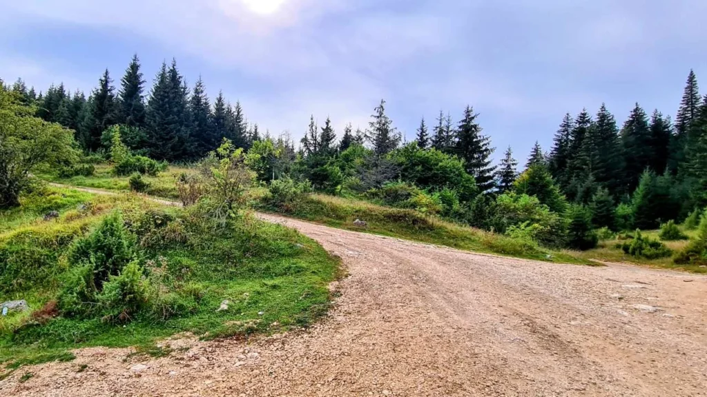
- Surface: asphalt at the start, then gravel and forest roads. Suitable for XC, gravel and e-bike riders.
- Three sources of drinking water: near the end of the climb to Ružica, after the Kasindolka canyon, and at the Beli Vuk amphitheatre.
- The route passes through bear and wolf habitat, so make noise and ride in a group.
The start and finish are in East Sarajevo, and this Jahorina MTB loop circles the foothills of Jahorina. Also check out the family-friendly route Giro di Ćiro Sarajevo Pale or all MTB routes around Sarajevo. The difficulty is explained by the ITRS classification.
Key sections of the route
01
Kasindo and the climb to Karaula
Warm up on asphalt to Kasindo, then tackle a strong climb to Karaula. The view of Kijevo keeps you motivated, and further on you ride rolling terrain via Klanac to Borije.
02
Ružica, Ulobić and the Kasindolka canyon
From Borije, the route climbs to Ružica, where you find the first water source. Next comes a descent into the village of Ulobić below Jahorina and a ride through the canyon of the Kasindolka stream.
03
Beli Vuk, Stari Bagrem and the descent
After the spring, turn left and climb to the Beli Vuk amphitheatre and the Stari Bagrem restaurant at Tvrdimići, then take the long descent back to East Sarajevo.
Wildlife: bears and wolves
Parts of the route around Ulobić pass through bear and wolf habitat. Make noise, ride in a group and don't set off at dusk.
Tvrdimići route characteristics
Primary activity
Cross-country, gravel
Route type
Loop route
E-bikes
Allowed, the route is suitable
Signal
Mostly available (over 70%)
Water
3 sources (Ružica, Kasindolka, Beli Vuk)
Physical demand
Demanding (L3)
Surface
Asphalt (start), gravel, forest roads
Trailforks
Tvrdimići MTB route map and elevation profile
The interactive map shows the exact route track and elevation profile. The forest roads around Ulobić can be confusing, so download the GPX for navigation. It is a handy MTB GPX Sarajevo file for any marathon MTB route in Bosnia.
Gear and riding tips
Mandatory
A helmet is mandatory. Carry about 1.5 l of water, as springs are scarce (at 7 to 25 km), plus a tire repair kit.
Recommended
An XC hardtail is ideal. This East Sarajevo MTB route is also well suited to e-bike and gravel riders.
Wilderness and signal
Signal is mostly available (over 70%), but evacuation is difficult. Download the GPX and tell someone your ride plan.
Pro tip
Editor Marko Ristivojević recommends riding in the opposite direction: the asphalt climb to Tvrdimići, then Ulobić, Ružica and Borije to Kasindo, leaving the gravel for the descent. Check your tires before the ride, and we do bike service in our workshop by appointment: book a slot.
Frequently asked questions
Where are the water sources on the Tvrdimići route?

There are three key sources: near the end of the climb to Ružica, on the climb to the left after leaving the Kasindolka canyon, and the fountain at the Beli Vuk amphitheatre.
How hard is the East Sarajevo MTB route to Tvrdimići?
It is physically demanding (L3) because of the 1133 m of climbing, but technically blue (L2): no extreme obstacles, mostly forest roads and gravel. The total ITRS score is 363.
Which bike is best for the Tvrdimići route?
An XC hardtail is ideal, and the route is also well suited to e-bike and gravel riders.
How long does the Tvrdimići route take?
The route is 42.3 km long, with 1133 m of climbing and 1117 m of descent. The average time is 3 to 5 hours.
Which direction is better for riding the Tvrdimići route?
We recommend the opposite direction to the one described: first the asphalt climb to Tvrdimići, then Ulobić, Ružica and Borije to Kasindo. That way you ride most of the climbing on asphalt and leave the gravel for the descent.
See you at Tvrdimići?
Browse all MTB routes in Bosnia and Herzegovina or contact us for advice on gear and service appointments.