MTB ROUTE · ZELENGORA · KALINOVIK
Kalinovik – Borilovačko Lake Zelengora MTB Marathon – 55 km
This Zelengora MTB route is a 55 km Out & Back ride from Kalinovik to Borilovačko (Jugovo) Lake in the heart of Zelengora, with 1074 m of climbing. Guide, map, GPX and ITRS difficulty rating in one place.

Distance
55 km
Descent
−1045 m
Highest point
1500 m
Ascent
1074 m
ITRS score
377

Difficulty (ITRS)
Blue route (L2)
Packed dirt and gravel

Physical effort
Demanding (L3)
1074 m of climbing over 55 km
ITRS Route Pie: route difficulty at a glance
The Route Pie shows the route's ITRS rating across four axes: technique, fitness and logistics, wilderness and risks, and exposure. Click the chart to open an explanation of difficulty, demands and the other parameters.
About the route
Kalinovik – Borilovačko Lake: an Out & Back Zelengora MTB route
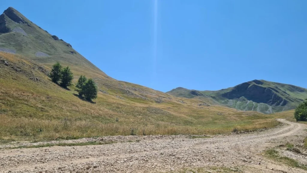
The Kalinovik – Borilovačko Lake route is a 55 km Out & Back ride with 1074 m of climbing and 1045 m of descent. You ride mostly on wide gravel roads through the heart of Zelengora in Sutjeska National Park, all the way to Borilovačko (Jugovo) Lake. Technically it is easy (L2) but physically demanding (L3), and the wilderness factor is L3 because of unreliable phone signal and difficult evacuation.
Quick summary
- Distance 55 km (Out & Back), ascent 1074 m, descent 1045 m (highest point 1500 m, lowest 1046 m).
- ITRS score 377: technique L2, fitness L3, wilderness L3, exposure L1.
- Surface: packed dirt and gravel. Suitable for XC, AM, gravel and e-bikes.
- Phone signal is unreliable (30-70%), and evacuation can take up to 6 hours.
- Water sources are rare (e.g. Konjska Voda): carry 1.5 to 2 l of water.
Check out other MTB routes in Bosnia. The difficulty is explained by the ITRS classification.
Key sections of the route
01
Start and Jelašca
The adventure begins in Kalinovik. You ride on asphalt for the first few kilometers, then the route turns right toward the village of Jelašca. After a short stretch of narrower gravel, it becomes a wide gravel road with a gentle climb.
02
"I Love Kalinovik" and Konjska Voda
The gentle climb peaks at kilometer 15. A few hundred meters further on is the wooden "I Love Kalinovik" frame with a viewpoint. A descent of a little over two kilometers follows, and at its start, to the left of the road, is the Konjska Voda spring.
03
Borilovačko Lake and the return
After the descent, the route climbs to Borilovačko (Jugovo) Lake, near the "Zelengora" mountain lodge. You return the same way (more than 26 km), and with a small detour you can also visit Orlovačko Lake.
Carry water and expect weak signal
Signal is unreliable (30-70%), evacuation can take up to 6 hours, and water sources are few. Carry at least 1.5 to 2 l of water per person.
Route characteristics: Kalinovik – Borilovačko Lake
Primary activity
55 km
Route type
1074 m
E-bikes
1045 m
Signal
1500 m
Water
1046 m
Physical demands
Packed dirt, gravel
Surface
AM, XC, gravel, e-bike
Trailforks
Kalinovik – Borilovačko Lake route map and elevation profile
The interactive map shows the route track and elevation profile. Load the GPX before you set off.
Gear and riding tips
Essential
At least 1.5 to 2 l of water, a spare tube, a pump, a helmet and food for a full day in the saddle.
Recommended
A windbreaker and warm clothing for mountain conditions, a charged phone and a power bank.
For racers
Load the GPX before you start, as the signal is unreliable.
Pro tip
Don't push too hard in the first 15 km. Fill your bottles at the Konjska Voda spring.
Frequently asked questions
How technically difficult is the Kalinovik – Borilovačko Lake route?

It is technically easy (ITRS L2, blue): wide, packed gravel with no rocky sections or roots.
How physically demanding is the route?
It is physically demanding (ITRS L3, score 377): 55 km out and back with over 1000 m of climbing. You need solid fitness for a full day in the saddle.
Where can I refill water on the trail?
There is water in Kalinovik at the start, and the best-known source on the route is Konjska Voda, to the left of the road at the start of the descent after km 15. Carry 1.5 to 2 l of water.
Is the route suitable for riding with kids?
The roads are wide and exposure is low (E1), but because of the 55 km distance and long climbs, it is recommended only for older kids who train or ride e-bikes.
Which bike is best for this route?
XC, AM and gravel bikes are ideal, and an e-MTB is a great choice for less effort on the climbs.
Ready for Zelengora?
Get your bike ready, load the route and browse all MTB routes in Bosnia, or contact us for advice on gear and servicing.